北台灣大地衛星遙測
Satellite Telemetering for North Taiwan Land


〝由本圖應可驗證台灣國家,缺乏管理國土的機制〞
We can see from the underlying photograph that Taiwan has a poor system in regard to the land planning and management.

Yenliao102.JPG (62164 bytes)
                                                                                 資料來源:國立中央大學太空遙測中心
                                                                      Resources:Space Telemetering Center ,National Central University
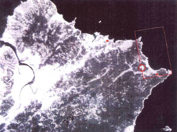
dot4.gif (381 bytes)從衛星遙測顯示整個北台灣大地生態環境已遭受嚴重破壞,在核四廠區後山集水區不知發生何事,雙溪河遇雨變黃河,貢寮荖蘭山主峰巨型水泥結構物和瑞芳更子寮段蝙蝠洞前南邊公路上土石流,來自何方等之原因,有待政府解釋?
dot4.gif (381 bytes)In the above satellite telemetering photograph ,We can clearly find the land ecology of North Taiwan has been seriously damaged. We don`t know what happened in the collecting basin on the rear hill of 4th Nuclear Power Plant? Shuanghsi River turns yellow once raining. Where were the big concrete structures on Laolan Mt.(kungliao) and lots of soils and stones on the road in front of Bats Cave at kengtzeliao(Juifang) coming from? We are waiting for the explanations by the Government.

prev.gif (1707 bytes)<P3> <回鹽寮反核> <至目錄區>next.gif (1760 bytes)