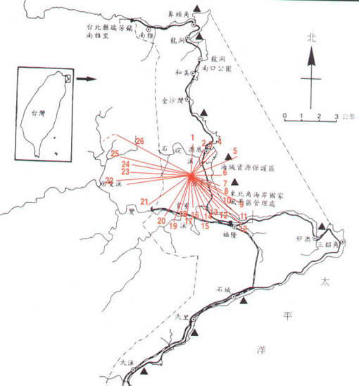
以核四廠中心直徑5000公尺內紅色危害區之分佈
Red Hazardous Zones within Diametrical 5,000 Meters of 4th Nuclear Power Plant


Yenliao121.JPG (32932 bytes)h

dot4.gif (381 bytes)上圖26處地區將為核四陪葬的地區,外加大基隆、大台北區域也難逃其害,因為核四廠設置在北雪山集雲區,風行線集風口的土地上,致核燃對空熱排直接為冷雲層所吸收而產生聚集效應,由少積多,再加上東北季風盛行促使聚集於雲層的放射素,隨之沿雪山陵現行降,因此基隆水源區、大台北翡翠水庫、大台北都會區所面臨的後果,可想而知。倘若發生意外事件,不知道政府因應之道在哪裡?註:(人造核放射的基性為冷伏熱揚)
dot4.gif (381 bytes)In addition to 26 places as indicated in the above map ,Keelung Metropolis and Taipei Metropolis are also within the scope of "disaster". 4th Nuclear Power Plant is built at the cloud region of North Snow Mountain; the cold cloud layer will directly absorb hot air discharged by the power plant. Moreover ,Northeast Monsoon is prevailing in this areas ,the radiation accumulated in the cloud layer will fall along the edge of Snow Mountain ,so Keelung water source ,Jadeite Dam and Taipei Metropolis all will be affected. In case of any accident ,we don`t know how the Government address ut?

prev.gif (1707 bytes)<P29> <回鹽寮反核> <至目錄區>next.gif (1760 bytes)